Keywords: Environment, Seagrass, ArcGIS Pro, Airbus, SPOT, Pléiades, Pléiades Neo, Special Area of Conservation
The Sound of Barra is a Special Area of Conservation (SAC) was designated for two Annex I European Habitats, including sandbanks that are slightly covered by seawater all the time, which encompasses seagrass beds. In addition, seagrass beds are a Priority Marine feature, and contribute to carbon sequestration, provide shelter to a range of other species and prevent erosion of the seabed. However, in the Sound of Barra the subtidal sandbanks are in unfavourable condition. Tracking the health and extent of these beds is, therefore, essential for long-term habitat management and restoration.
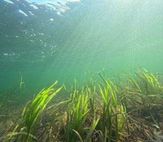
Mapping extent of seagrass beds is important for monitoring the condition of beds in the SAC. The seagrass reduces in coverage over the winter, and increases over the summer, with a maximum coverage reached in August to September. Aerial imagery is available through a nationwide contract, though is only collected every three or four years. Infrequency of aerial survey flights means this data doesn't provide the temporal resolution needed to capture seasonal changes or detect short-term degradation. High resolution satellite imagery therefore offers another way to monitor the extent of seagrass between these years, and a way to monitor seasonal change in coverage within a single year.
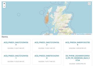
The EO Data Hub was used to search for suitable cloud-free, high-revisit imagery. By determining the availability of useful Airbus data for the application area using EODH search functionality, a fitness-for-purpose assessment could be carried out prior to analysis. The commercial data catalogue was used to define the search for the months of August and September for particular years, to define the search area (as a bounding box) and to restrict the area of cloud cover. The search returned a range of candidate images, which were initially assessed through thumbnails. The results included imagery from three commercial data collections:
Airbus SPOT6 (1.5m resolution)
Airbus PHR (0.5m resolution)
Airbus PNEO (30cm resolution)
Four high-quality images captured between 2023 and 2024 were selected for further analysis. Python notebooks were used to automate and streamline the ordering process, simplifying the transition from search to acquisition.
The next step was to download these images to a local machine in order to work with them directly in ArcGISPro. Once the image files were imported into the software, information on subtidal seagrass bed location was extracted by carrying out an extent delineation using GIS tools. Finally, a simple classification operation was carried out. Opportunities to synergise the commercial data provided by the EO Data Hub with aerial photography, LiDAR and other data external to the Hub would allow for advanced insights in future.
Using the EODH as a simple point of access for high resolution and high revisit cloud-free commercial data allowed an easy way to kickstart the process of seasonal seagrass extent monitoring in the Sound of Barra. Search workflows were easy to follow and rapid to execute. Refining search constraints with useful filters such as temporal range, spatial extent, collection type and cloud cover returned a valuable selection of imagery specific to the use case. Finally, access to both commercial and open data in one place allowed for a useful comparison of fitness for purpose, and facilitated easy piloting of a potential project, study, or analysis.
Read more about environmental management and protection of Scottish natural landscapes at NatureScot